
File:Districts of the Bono East Region (2019).png

Dis preview ein size: 800 × 556 pixels. Oda resolutions: 320 × 222 pixels | 640 × 445 pixels | 1,024 × 711 pixels | 1,438 × 999 pixels.
Original file (1,438 × 999 pixels, file size: 363 KB, MIME type: image/png)
.png)
Summary
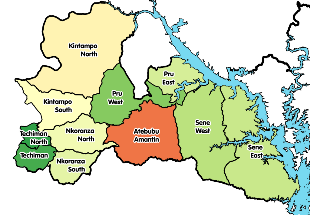
| Description | Map showing the districts of the Bono East Region of Ghana in 2019. |
| Date | |
| Source | Own work |
| Author |
|
Licensing
I, the copyright holder of this work, hereby publish it under the following license:
This file is licensed under the Creative Commons Attribution-Share Alike 4.0 International license.
- You make free:
- to share – to copy, distribute de transmit de work
- to remix – to adapt de work
- Under de following conditions:
- attribution – You for give appropriate credit, provide link to de license, den indicate if dem make changes. You fi do so for any reasonable manner insyd, but no be any way wey dey suggest de licensor dey endorse you anaa your use.
- share alike – If you remix, transform, or build upon de material, you fi distribute your contributions under de same anaa compatible license as de original.
File history
Click date/time top so say you go view de file as e appear for dat time.
| Date/Time | Thumbnail | Dimensions | User | Comment | |
|---|---|---|---|---|---|
| current | 18:06, 19 March 2021 | | 1,438 × 999 (363 KB) | Jakob Gottfried | {{Information |Description=Map showing the districts of the Bono East Region of Ghana in 2019. |Source={{own}} |Date=2021-03-16 |Author= *Derivative work: User:Jakob Gottfried *Original work: User:Macabe5387 |Permission= |other_versions= }} Category:Maps of the Bono East Region |
File usage
De following 6 pages use dis file:
Global file usage
De following oda wikis dey use dis file:
- Usage for ceb.wikipedia.org top
- Usage for de.wikipedia.org top
- Usage for dga.wikipedia.org top
- Usage for en.wikipedia.org top
- Usage for es.wikipedia.org top
- Usage for incubator.wikimedia.org top
- Usage for it.wikipedia.org top
- Usage for pl.wikipedia.org top
- Usage for www.wikidata.org top
- Usage for yo.wikipedia.org top
- Usage for zu.wikipedia.org top
.png)